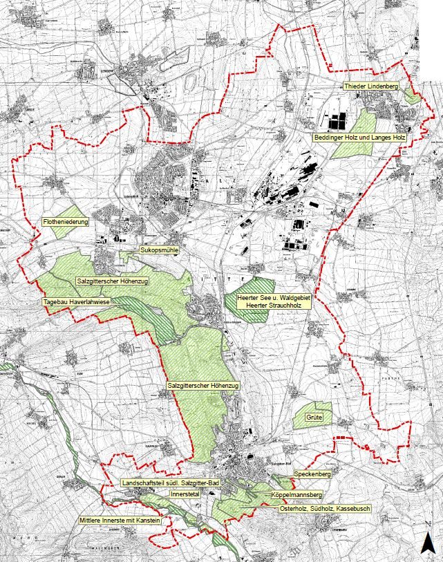
Nature conservation areas (NSG)
| No. | Designation | Area (ha) |
|---|---|---|
| BR14 | Köppelmannsberg | 6,3 |
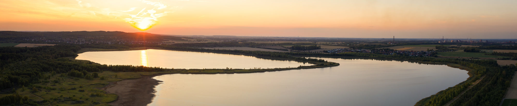
| BR61 | Heerter See and forest area Heerter Strauchholz | 323 |
| BR112 | Speckenberg | 8,2 |
| BR131 | Middle Innerstetal with Kanstein | 562.6 / share SZ: 63 |
| BR149 | Haverlahwiese open-cast mine | 206 |
Landscape conservation areas (LSG)
| No. | Designation | Area (ha) |
|---|---|---|
| LSG SZ 1 | Sukopsmühle | 28,4 |
| LSG SZ 3 | Grüte | 60,0 |
| LSG SZ 6 | Thieder Lindenberg | 39,9 |
| LSG SZ 7 | Innersetal | 158,2 |
| LSG SZ 8 | Salzgitter ridge | 2.200 |
| LSG SZ 9 | Landscape area south of SZ-Bad |
130,6 / Share SZ: 125.6 |
| LSG SZ 10 | Bedding wood and long wood | 234,0 |
| LSG SZ 11 | Flotheniederung | 134,0 |
| LSG SZ 12 | Osterholz, Südholz, Kassebusch | 257,0 |
Downloads:
- Overview map of protected areas in SalzgitterPDF-File4,76 MB
- Area balance of the protected areas in SalzgitterPDF-File23,80 kB
- Köppelmannsberg nature reserve, regulationPDF-File106,98 kB
- NSG Köppelmannsberg, mapPDF-File578,66 kB
- Heerter See nature reserve and Heerter Strauchholz forest area, ordinancePDF-File114,69 kB
- Heerter See nature reserve and Heerter Strauchholz forest area, mapPDF-File259,72 kB
- Speckenberg nature reserve, regulationPDF-File67,18 kB
- NSG Speckenberg, mapPDF-File64,99 kB
- Middle Innerstetal National Nature Reserve with Kanstein, OrdinancePDF-File466,35 kB
- NSG Mittleres Innerstetal with Kanstein, mapPDF-File215,63 kB
- NSG Haverlahwiese open-cast mine, regulationPDF-File99,39 kB
- NSG Haverlahwiese open-cast mine, mapPDF-File352,16 kB
- LSG Sukopsmühle, regulationPDF-File51,72 kB
- LSG Sukopsmühle, mapPDF-File69,32 kB
- LSG Grüte, OrdinancePDF-File30,44 kB
- LSG Grüte, mapPDF-File79,42 kB
- LSG Thieder Lindenberg, regulationPDF-File65,67 kB
- LSG Thieder Lindenberg, mapPDF-File61,28 kB
- LSG Innerstetal, OrdinancePDF-File48,83 kB
- LSG Innerstetal, mapPDF-File215,63 kB
- LSG Salzgitter Hills, OrdinancePDF-File26,10 kB
- LSG mountain range, mapPDF-File417,00 kB
- LSG landscape area south of Salzgitter-Bad, regulationPDF-File65,23 kB
- LSG landscape area south of Salzgitter-Bad, mapPDF-File4,13 MB
- LSG Beddinger Holz and Langes Holz, regulationPDF-File62,03 kB
- LSG Beddinger Holz and Langes Holz, mapPDF-File97,93 kB
- LSG Flotheniederung, ordinancePDF-File63,02 kB
- LSG Flotheniederung, mapPDF-File1,77 MB
- LSG Osterholz, Südholz, Kassebusch, regulationPDF-File139,95 kB
- LSG Osterholz, Südholz, Kassebusch, mapPDF-File1,30 MB